Rare airs come together for snowstorm
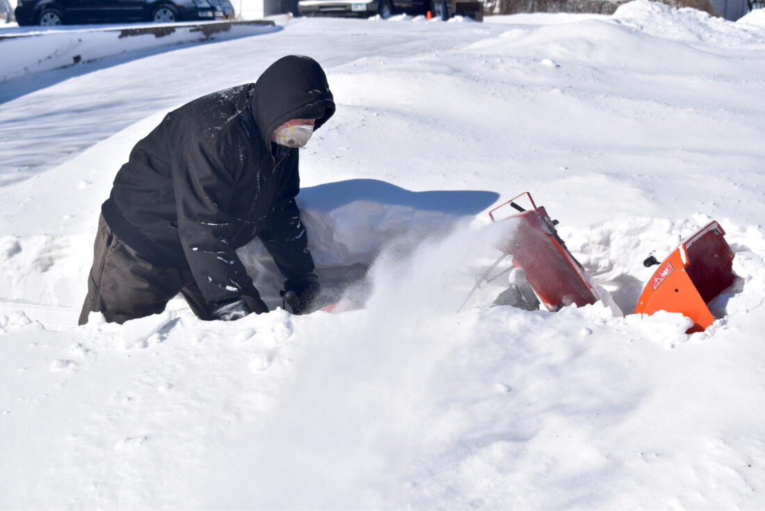
ABOVE: The snow drifted so high that Mark Atkinson’s snow blower can barely be seen as it tries to work its magic near Downtown Plaza in Fairmont in the aftermath of Sunday’s snow and wind that lasted well into Monday.
FAIRMONT – A mid-March snowstorm with six inches of snow and winds gusting at over 40 mph closed schools, roads and caused several minor accidents.
National Weather Service Meteorologist Eric Ahasic said Fairmont was near the tail end of the storm, hence the lower snow total amount in comparison to the 20 inches received in areas like southeast Minnesota and further into Wisconsin. Even so, Ahasic said it was other factors that made the storm dangerous here.
“We had the winds in Fairmont and in south central and southwest Minnesota,” he said. “Even though the snow ended Sunday morning, the winds picked up as the low-pressure system moved off to the east, which is pretty common with these storms. We saw those winds of 40 to 50 miles an hour which, coupled with the six-plus inches of snow, led to blizzard conditions all the way into Sunday night.”
What made this system so strong was the combination of two sources of moisture, according to Ahasic.
“We actually had some moisture swimming in from the Pacific Ocean, which was several thousand feet above the ground, the upper-level moisture at the storm. You could trace that back all the way to Hawaii. In the lower levels, toward the end of the system, we had some Southeast winds that brought in some moisture toward the Atlantic. Down towards Florida and the Bahamas, that area. We had double streams of moisture flowing into the area.”
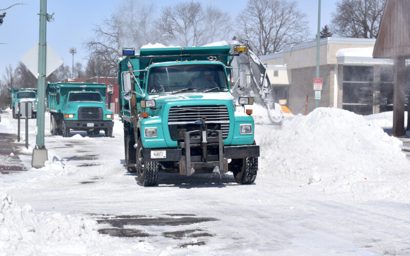
ABOVE: After having cleared off the roads, a much larger snow blower drives through the medians of snow on North Park Street in between the U.S. Bank Branch and St. Martin’s Episcopal Church, depositing them into a City of Fairmont dump truck, with more trucks waiting behind it.
It was very close to being worse as well. While Fairmont measured at six inches of snow Monday morning, Winnebago, only around 23 miles away, registered eight inches in the same period of time.
Going in, Ahasic said the NWS had predicted the Martin County area to be on the southern edge of the heaviest snow, and they feel the forecast made was overall spot-on.
“We knew the winds would pick up,” Ahasic said. “We had the blizzard warning issued the day before, which is pretty rare for us to have one that far ahead of time, because we just knew that it wouldn’t take that much snow to lead to really bad conditions when those winds pick up.”
And bad conditions there were. By 6 p.m. Sunday, the state highways were all closed and did not open until 10:30 a.m. Monday. On those state highways, the State Patrol measures incidents by districts, with Martin County’s district also including Faribault, Watonwan, Blue Earth, Waseca, Brown, Nicollet, Sibley, Le Sueur and McLeod counties.
Across all of them, there were two injury crashes, three jack-knifed semis, six property damage crashes and 66 vehicles that went off the road. Given how long the roads had been closed, State Patrol Sergeant Troy Christianson said those numbers were actually on the higher side.
“A lot of it was before we were actually able to get the roads closed,” he said. “It takes a lot to actually close I-35 and I-90, because we have to have other states depend on the same. If we shut it down, they’re gonna have to close it down as well. We need South Dakota to close it down, and also Iowa as well. There’s a certain point where the plow trucks just weren’t able to keep up with the amount of snow that was coming down, and the strong winds made for very poor visibility.”
Even after the roads were reopened, No Travel advisories were not lifted until later in the day, and Martin County portions of Highways 90 and 15 were still covered in ice, as reported by the MnDOT 511 system. As such, Christianson said they were still plenty busy Monday. As of Monday afternoon, he said the roads were still in the ‘don’t travel unless you have to’ territory.
“If you do, allow enough time to get to where you went safely, and just be prepared to drive it at a much slower speed and check the roadways. Go to 511mn.org for the road conditions and make sure the roads gonna be traveling are open.”
In town, Fairmont Police Captain Chad Sanow said thankfully, there were only a few motorists who got stuck during the snowstorm.
“Fairmont is a good community,” he said. “We usually don’t have a lot of problems.”
For the rest of this week, Ahasic said there’s another light snow event coming this afternoon and evening. After that, it should warm up and eventually reach and exceed the warmth from last week.
“I would expect it to melt pretty quickly through Wednesday, and especially by Thursday,” he said. “It’s looking like you could be in the 60s by Friday into Saturday, if we can get rid of most of that snow on the ground, even some 70s possible. It is going to get a lot warmer. It just depends on how fast we melt all the snow.”
Looking forward, Ahasic said thankfully there are no signs for another major snowfall throughout the rest of March.
Local News

Rare airs come together for snowstorm
Briefly
Fairmont Speech competes at Woodbury/Eagan Six members of the Fairmont Speech Team competed at the National ...
Truman looks over sidewalk bids, campground rules
TRUMAN— On Monday the Truman City Council considered three bids for the Highway 15 sidewalk extension project, ...
Coffee Lovers meet Thursdays at Lake Belt
CEYLON — A cribbage tournament will begin with registration at 1:15 p.m. today, Saturday, March 14, at the ...

Pork Producers form Hall of Fame